
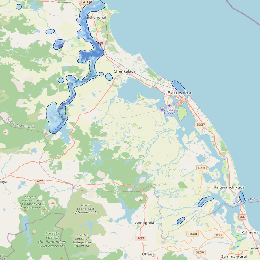
The flood forecast bulletin from the most recent completed simulation run, alongside the live 2-D floodplain inundation map from the model dashboard.
| Junction | Peak flow | Threshold | Status |
|---|---|---|---|
| Mundeni Aru | 40.2 | 300 | normal |
| Magilawattuwan (Wadamunei) | 14.0 | 100 | normal |
| Maduru Oya | 33.7 | — | watched |
| Andella Oya | 39.9 | — | watched |
Four web tools sit on top of the live database — accessible to operators, partners and decision-makers.
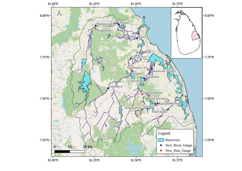
Real-time rainfall and water-level observations from 10 RiverNet stations across the Batticaloa basins.
FlaskFolium →🌧️Animated hourly ECMWF rainfall forecast with station hydrographs. 9-day lead time at 9 km resolution.
FlaskLeaflet →📈Explore observed rainfall, ECMWF forecast time-series and data-preparation tools for every gauge.
Streamlit →📊Operator console — system status, streamflow forecasts, hydrographs, inundation maps and flood alerts.
StreamlitThe Batticaloa Flood Early Warning System (BFEWS) is an operational, physically-based flood forecasting system covering the basins that drain into the Batticaloa lagoon on Sri Lanka's east coast. It combines real-time rain and water-level observations with ECMWF rainfall forecasts and a chained HEC-HMS / HEC-ResSim / HEC-RAS model suite to produce 9-day streamflow forecasts, floodplain inundation maps and threshold-based flood alerts.
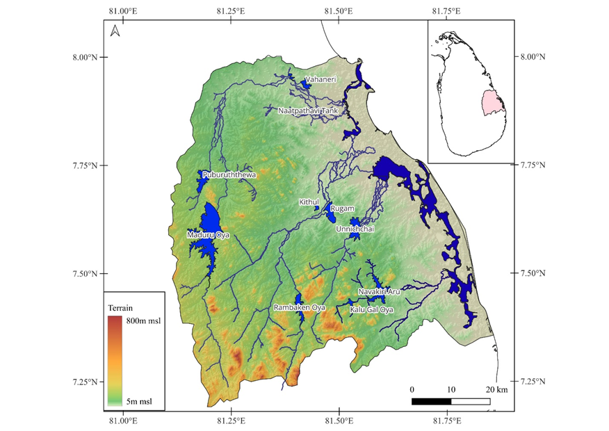
Four major river basins feed the Batticaloa floodplain. Each is modelled end-to-end — from upstream rainfall–runoff, through reservoir operations, to 2-D floodplain hydraulics around the lagoon.
A dedicated network of telemetered rain and river gauges feeds the system every few minutes. Live data is hosted at rivernet.lk and ingested into BFEWS through the obs-collector service.
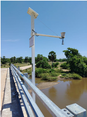
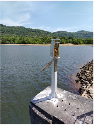
Gauges are deployed on bridges and tank bunds across the four basins, with solar-powered telemetry feeding real-time data into the central database. Stations are accessible publicly at rivernet.lk.
BFEWS chains three USACE Hydrologic Engineering Center models — HEC-HMS, HEC-ResSim and HEC-RAS — each handling one stage of the rainfall-to-flood pathway. Models run on a dedicated server while only the observations and live outputs are exposed. Sri Lanka's Irrigation Department set up these models and continuously refines them based on field measurements and observations.
Rainfall–runoff modelling for each of the four upstream basins. Produces streamflow time series at every junction in the network.
Routes upstream inflows through the Maduru Oya and Unnichchai reservoirs using operational rule curves, producing controlled releases.
Two-dimensional unsteady simulation of the Batticaloa floodplain — generates hourly inundation maps with depth and velocity at every grid cell.
Each basin has explicit trigger thresholds combining reservoir water-level and accumulated rainfall. When any trigger fires for a forecast cycle, the Distributor service generates a bulletin and pushes it to subscribed operators by email and FTP.
| Basin | Reservoir | Alert level |
|---|---|---|
| Andella Oya | With reservoir | WL > 33 m (msl) and 24 h rainfall 100–135 mm; or WL < 33 m and rainfall > 190 mm in 24 h |
| Magilawattuwan | With reservoir | WL > 27 m and 24 h rainfall 100–135 mm; or WL < 24 m and rainfall > 190 mm in 24 h |
| Mundeni Aru | Without reservoir | High likelihood of 24 h rainfall > 135 mm |
| Maduru Oya | Without reservoir | High likelihood of 24 h rainfall > 135 mm |